Ten things to know before you go
In July 2026, Ann and I spent just over two weeks walking the length of the Lofoten archipelago in Arctic Norway. We flew north to Harstad/Narvik (Evenes), took a bus down to Svolvær, and from there travelled almost entirely under our own steam — on foot, with a handful of local bus hops and a ferry across Reinefjord — heading south down the island chain to Reine and Å before winding down near Leknes. Sixteen days, around 80 km of walking, seven nights wild camping, and a sun that never once set.
It was one of the best and most demanding trips we’ve ever done. If you’re thinking of something similar, here are ten things we wish we’d fully appreciated before we set off.
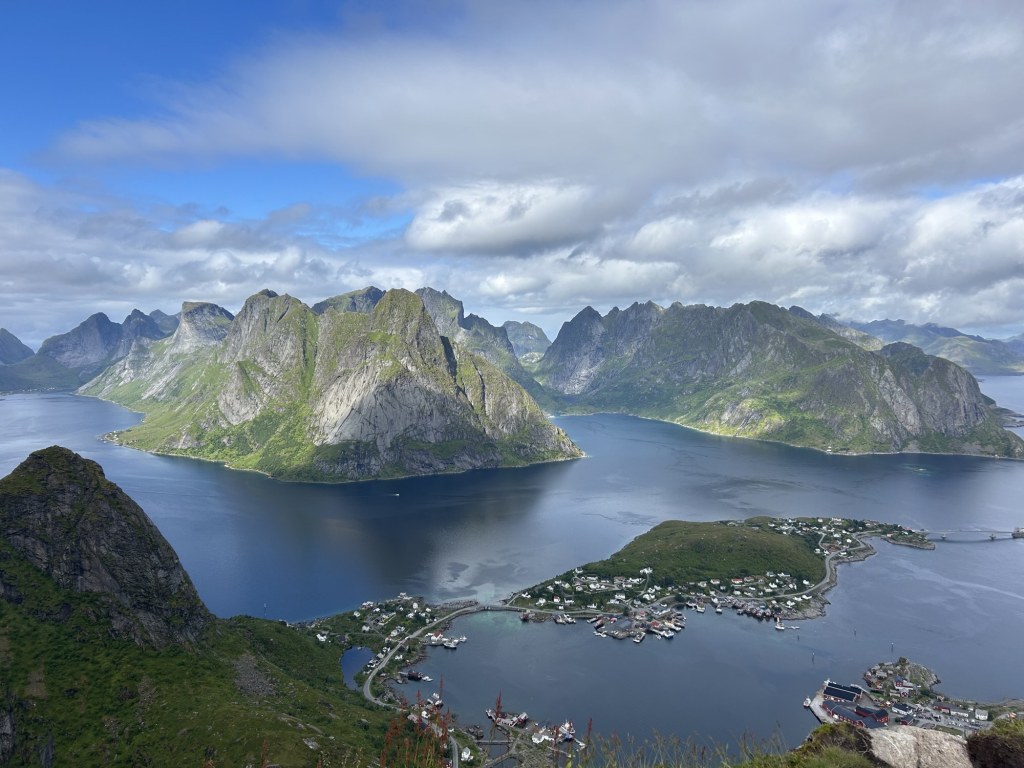
1. The weather is genuinely unpredictable.
We were there from 9 to 24 July — high summer — and the coldest it got, with wind chill, was 2°C. It rained on most days, and at one point the wind gusted to 80 km/h, a gale-force 8. Pack for all four seasons, because you can get them in a single afternoon. Weather forecasts are mostly useless.
2. The terrain is unforgiving — and don’t trust the flat bits either.
The scenery is jaw-dropping precisely because 600-metre peaks rise straight out of the sea. The flip side is relentless climbing and descending — and even the gentle-looking stretches can’t be trusted. A flat path around a lake will suddenly turn into bog, or into a hop from boulder to boulder where the glaciers left their scars across the ground. Trekking poles were one of the best decisions we made: invaluable for testing soft ground, balancing across rocks, and saving our knees on the long descents. And plan your days around time, not distance — on the roughest ground, 1 km/h was a perfectly normal pace. Every viewpoint here is earned.
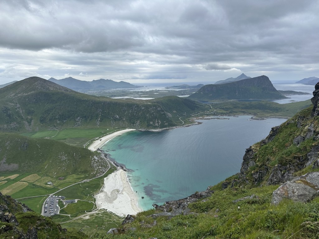
3. When it rains, the trails become streams.
A path is usually the line of least resistance for water, so the moment the weather turns, your route quickly becomes a running beck beneath your boots.

4. You will have wet feet. Make your peace with it now.
Most of the ground is a thin (~20 cm) layer of peaty soil sitting on ancient impermeable rock — the granite and gneiss here is some of the oldest exposed stone in Europe, around 1.8 billion years old. That peat soaks up rain like a sponge, so even well above the sea you can find yourself ankle-, shin-, and occasionally knee-deep in water.
5. The trails are very much “at your own risk.”
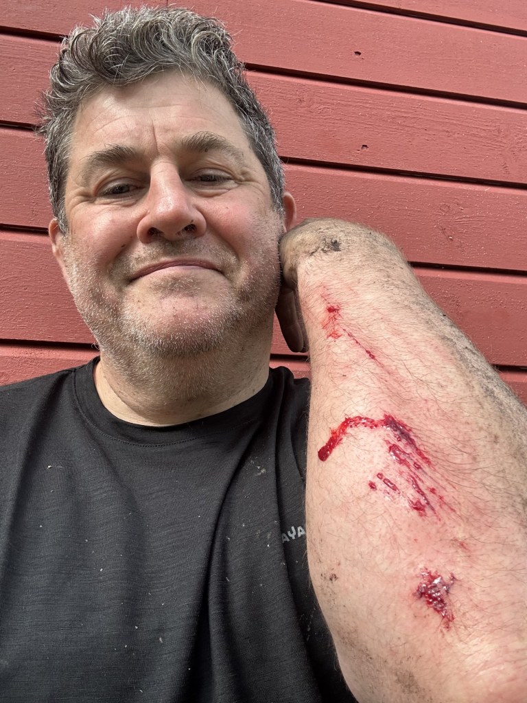
Once you’re more than a couple of hours from a trailhead, signposting is minimal to non-existent, and in the wet the going can be genuinely dangerous. We turned back from one route that would have had us cross sloping, slick rock above a 20-metre drop into the sea. And even where we did press on, the wet ground caught us out — I came down hard on one muddy descent and had to break out the first-aid kit to patch up my elbow. You’re expected to know your limits and manage your own risk — nobody else is going to do it for you.

6. Pack light — but not too light.
You will regret that porcelain coffee filter after a few thousand metres of ascent. But there’s a balance to strike: your gear has to cope with sustained wet and cold, so this is not the place for your flimsiest ultralight kit. In particular, don’t skimp on the tent — when it’s blowing a gale sideways at 2°C, you’ll be very glad you brought something that can genuinely stand up to it.
7. The public buses are infrequent but excellent.
You have to plan your route around them, but the Entur app makes that easy — timetables, tickets, and real-time bus tracking all in one place. Honestly, the islands don’t need any more cars or camper vans.
8. Norway is expensive — brace yourself.
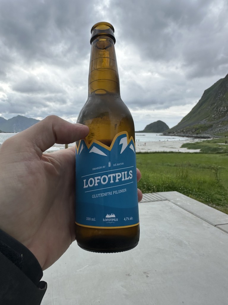
Food is roughly London prices; alcohol is dearer still — perhaps €16 for a 33 cl beer in a restaurant, though considerably cheaper from the supermarket. And note: the shops don’t sell alcohol on Sundays.
9. You’ll meet some wonderful people.
I know solitude is often the whole point — and on the popular trails near the villages (Reinebringen above all) you will share the path with a lot of people, of all types. But get more than three hours out from any trailhead and you’ll mostly meet the hardy few walking the long Lofoten traverse. They’re good people to fall into step or share a story with.
10. The views are extraordinary — no filter required.
Even straight off the camera, with nothing added, Lofoten barely looks real.
A quick word on the wildlife
It’s a bonus rather than the main event, but the birdlife alone was worth the trip. Over the two weeks we spotted rock ptarmigan, oystercatchers, terns, and more gulls than we could count — and, memorably, a young sea eagle hunkered down out of the rain.
A word on food
For the wilderness legs we mostly ate dehydrated expedition meals — Expedition Foods and Summit to Eat, both good — but even the good ones get a bit boring after a week, so stock up on snacks to break the monotony. Our favourite evening treat was some reindeer salami: a small, dense luxury that more than earned its place in the pack. One small warning: the tea over there is dire (Lipton, at least), so if you care about a decent brew, bring your own.
What we carried
Travelling as a couple is a real advantage: you can share the heavy communal items between two packs. Fully loaded with food and fuel, Dan’s pack came in at about 12 kg and Ann’s at about 8 kg. Two principles drove every choice — it had to handle sustained wet and cold, and (see #6) the shelter had to be genuinely storm-worthy rather than merely light.
Shared between us
- Our Hilleberg Nallo 3 tent — deliberately not the lightest, and worth every gram: plenty of room to stash wet gear, it shrugged off the gales, and kept us warm and dry the whole trip (thanks, Hilleberg!)
- A double quilt rather than two sleeping bags (warmer and lighter for a couple)
- Trangia meths stove with the triangle stand, plus a fuel bottle filled with rødsprit bought in Svolvær (you can’t fly with stove fuel)
- Cooking pots and utensils, knife, bottle opener
- Water filter (which broke, but isn’t necessary…), a Nalgene and a 2-litre water carrier
- 1:50,000 map and compass as the backup navigation, with phones as primary. The Caltopo app is your friend! Buy a subscription for offline maps. Plot your routes before you leave.
- Garmin inReach Mini 3 satellite messenger — SOS, two-way text and weather (not a map) for when out of reach of mobile data (which did occur but was quite rare).
- One head torch (plenty under the midnight sun), power banks and cables
- First-aid kit and suncream
- Tiny electric pump to inflate matts and pillows. Such a timesaver when you are making camp everyday!
One each
- Sleeping pad, pillow and Ortlieb dry bags.
- Base layer, mid-layer, a puffer or fleece, and a waterproof shell jacket
- Dry clothes to sleep in
- Hiking trousers, waterproof over-trousers, shorts and a t-shirt
- Around four pairs of socks each — spares matter when your feet are permanently wet
- Hat or buff, hiking boots, sandals for camp, and a towel
- Trekking poles (see #2 — worth every gram)
(This is straight from our own kit list — adjust to taste.)


Leave a comment